Most statistics on vineyards around the world are the result of self-reporting by vineyard owners and therefore about as approximate or inaccurate as the information divulged by patients to their doctors regarding alcohol consumption. (See Richard’s article on Death by wine and the forum thread it provoked.)
When we are revising reference books such as The Oxford Companion to Wine or The World Atlas of Wine, it is a constant battle to get up-to-date information on vineyard areas, let alone the more specific data I had to find for grape varieties in Wine Grapes.
Not only is the data approximate but in some cases it is not produced very often: Italy, for example, does an agricultural census only once every ten years.
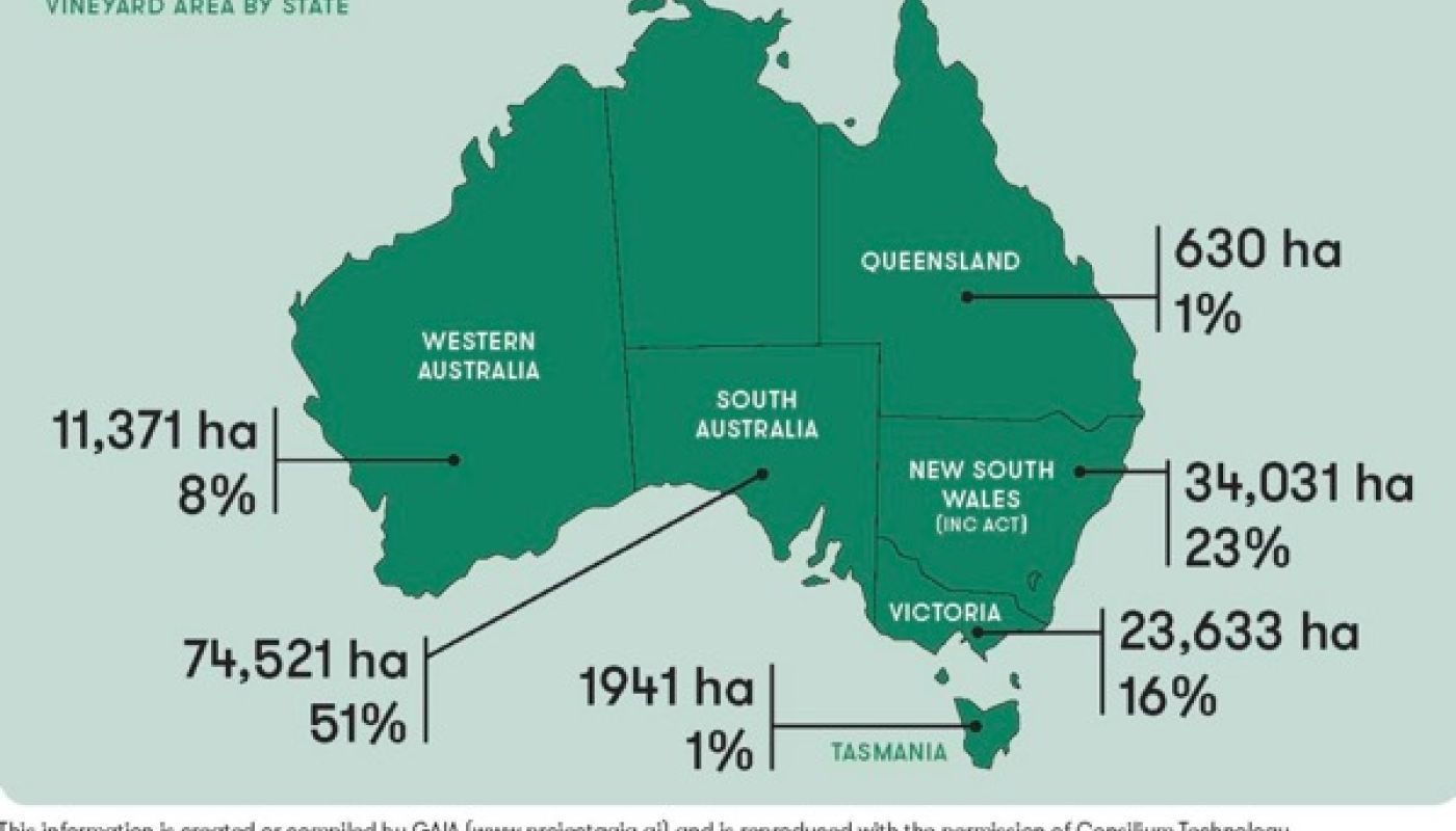
Hurray once again for the technology- and publication-savvy Australians. Wine Australia have just published the results of their National Vineyard Scan 2018.
Rather than relying on patchy self-reporting from busy winegrowers who would rather be out in the vines than accounting for them, Wine Australia have funded a project ‘to identify and map the locations of all vineyards across Australia, to determine the total area of vineyards in Australia by geographical indication (GI) and to develop a repeatable, scalable, cost-effective solution for updating and tracking vineyard plantings over time’.
This has been done using an algorithm to scan aerial imagery and detect vineyards 'without human intervention', work carried out by Consilium Technology and currently scheduled to be repeated in 2019 and 2020.
See the Wine Australia website for more background or download the pdf of Consilium’s summary report, which lists the vineyard area for every one of the coutry’s 65 GIs. (The full report can also be downloaded from the Wine Australia web page.)
The highlights are graphically presented below. I dream of the day when such information is available for every country that grows vines.