Note: In order to deliver this article to you as early as possible, it has been translated with the use of AI. It has been added to a queue for a human translator to fully review and edit. Please pardon any minor translation imperfections while it is being reviewed.
今年早些时候,在我开始探索艾吉亚莱亚山坡 (Slopes of Aigialeia)之前,在北伯罗奔尼撒半岛的第一个晚上,安杰洛斯·鲁瓦利斯 (Angelos Rouvalis) 给了我一份完美的礼物:一张简单而富有启发性的地图。
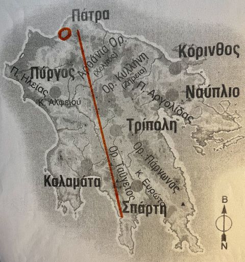
他从科林斯湾上的城市帕特拉 (Patra) 向南画到斯巴蒂 (Sparti) 的橙色线条突出显示了山脉如何将伯罗奔尼撒半岛从较干燥的东部分割到较湿润的西部。在北部海岸,帕特拉以东,艾吉亚莱亚山坡上的葡萄园,正如其名称所示,不仅比帕特拉南部和西部...